Friday, October 14, 2011

Expanding Light Rail in Buffalo


One of the recurring themes in all of literature is the struggle a writer engages with their native home. From Homer to Hemingway, authors across the ages have explored and reflected upon the influence of the place of their birth or upbringing. While this recurring archetype can cause out-sized coverage of the writer's formative community, it can also yield valuable insights and perspectives on the place's culture, traditions and identity that an outsider would have a hard time accessing.

With such a heady and theoretical opening, the direction this post is heading should be obvious: developments in passenger rail on your blogger's native turf, in this case news of a forthcoming study of expanding the light-rail system in Buffalo, N.Y. And, some context will surely be helpful in connecting this blogger with Western New York and its transit network.

Back in 1985, Buffalo opened a 6.4-mile light-rail line, connecting the city's downtown with the South Campus of the State University of New York at Buffalo (SUNY UB), which enrolls more than 29,000 students each year and is the largest university in New York State. Your blogger was aboard the very first day of service, and the experience sparked a lifelong passion and interest in community and public transportation, especially passenger rail.

The route – dubbed Metro Rail by the Niagara Frontier Transportation Authority (NFTA), the regional public transit agency which provides transit service in Erie and Niagara counties – marked Buffalo as one of North America's earliest adopters of the modern light-rail mode, following only Edmonton in 1978 and Calgary and San Diego in 1984 – predating most of today's larger light-rail networks in places like Portland, Denver and Dallas. Metro Rail was designed to revitalize commercial and retail activity downtown by serving residential neighborhoods in north Buffalo and its immediate suburbs, the college campuses of UB and Canisus College, and two hospital centers along the line. For a full background on Metro Rail, visit sites here and here.

Unique among modern light-rail systems is Metro Rail's 5.2-mile subway beneath Main Street, by far the bulk of its route miles (another 1.2 miles of the system operates above ground downtown in a pedestrian mall on Main Street, terminating at the First Niagara Center, home to the N.H.L.'s Buffalo Sabres). Among light-rail networks built after 1981, few utilize subway tunnels to the extent used in Buffalo. While a few short light-rail subway segments exist in St. Louis, Dallas, Portland and Los Angeles, subways were more common for hold-over light-rail operations, when lower construction costs made light-rail subways in viable in Boston, Newark, Philadelphia, Pittsburgh and Cleveland. A notable exception is Seattle's recent conversion of its downtown bus tunnel to accommodate its Link light-rail trains. And Ottawa is currently planning a new light-rail service that will construct a 1.5-mile tunnel through the downtown of Canada's capital city.

Buffalo ended up with a light-rail tunnel for several reasons. Planners had initially designed the line in the inverse of its current orientation, with a 1.2-mile subway downtown, and a 5.2-mile at-grade segment running in designated lanes above ground on Main Street outside of downtown. However, factors of geology in downtown Buffalo – particularly at the line's southern terminus at the city's waterfront – inflated the costs of tunnels downtown. Moreover, given that the light-rail mode was relatively new in North America, leaders at Canisus College and its surrounding neighborhoods were concerned about the appearance of overhead catenary wires through the campus. When combined, these demands necessitated flipping the plans, resulting in Metro Rail's current short surface, long subway configuration.

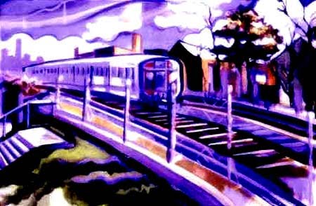
1980s rendering of Buffalo subway system
The most significant consequence of the change in plans was the skyrocketing project cost. Initially, the project was intended to not only link downtown and UB's South Campus, but extend into the neighboring town of Amherst where UB had stationed its primary (North) campus in the 1970's, about 3 miles north of the South Campus. In fact, the primary motivation for the light-rail service was to connect the two campuses and downtown with frequent, high-capacity rapid transit service, a concession to the city of Buffalo when the majority of its namesake university would be located outside the city limits. However, the decision to construct most of the route underground quickly absorbed the project's $535 million budget (in 1985 dollars), forcing the completion of the line between the North and South campuses to be placed on indefinite hold.

It's within this context that Buffalo's Metro Rail light rail has existed since 1985, as a 14 station, 6.4-mile  stand-alone route, averaging between 22,000 and 25,000 weekday riders, making it one of the best-utilized rail transit routes in North America per mile. Nonetheless, its role in revitalizing Buffalo is far less certain. The city's population plummeted after 1950, from more than 580,000 then to less than 300,000 today. And while much of that population shifted into nearby suburban communities, and Metro Rail certainly was not the cause of the population exodus – in fact, its consistent ridership counts are all the more impressive in that environment – commercial activity remained stagnant, at best, downtown, while its retail component largely vanished, and the two UB campuses remain unconnected but for sporadic bus service provided by the university. According to those measures, the service did not live up to its billing.

Metro Rail at the South Campus station
Buffalo Niagara Medical Campus – located within blocks of Metro Rail's Allen-Medical Campus subway station – has rapidly expanded over the same time, to conduct centrally-located health care, medical research and entrepreneurship, hosting over 8,000 employees, 500 medical doctors, 200 PhDs and 700,000 annual patient visits to produce more than $600 million in annual expenditures, creating a $300 million economic impact. UB – which already had a significant presence at the campus – recently announced it would locate its entire medical school at the facility, further bolstering the importance of the site. Lastly, a steady resurgence of the city's waterfront area – where Metro Rail trains currently terminate their inbound trips – is positioned downtown for even greater activity and vitality.

The current synergy of development in Buffalo has caused leaders at the local, state and federal levels to reexamine the original purpose of Metro Rail: to connect both UB campuses with downtown. As reported yesterday by the Buffalo culture and urbanism blog, Buffalo Rising, New York's U.S. Senators Charles E. Schumer and Kirsten Gillibrand announced the Federal Transit Administration awarded the NFTA $1.2 million to conduct an alternatives analysis on the transit corridor between the UB North and South campuses. The award marks the first occasion since the original Metro Rail project that federal funds will support the study of a high-capacity transit corridor in Western New York. As part of the federally-required alternatives analysis process, the study will examine a series of options for the corridor, including no-build, minor improvements, and bus and rail capital projects. The NFTA will jointly conduct the study with the region's metropolitan planning organization, the Greater Buffalo-Niagara Regional Transportation Council.

While it's possible the study process will determine any of those options – including no build or incremental improvements, along with bus-focused service, like bus rapid transit – is the most desirable use of public investment for the corridor, an extension of Metro Rail to the North Campus in Amherst has strong merits as well. Most significantly, it would allow a one-seat trip between the North Campus, the Buffalo Niagara Medical Campus and downtown Buffalo, and more fully utilize the community's existing asset of the Metro Rail infrastructure, including its high-speed subway tunnels. Additionally, two of the three most likely alignments for a light-rail extension to Amherst would also provide a one-seat train ride between the North and South campuses (I'll explain the differences between the three likely alignments shortly). Moreover, Metro Rail would allow for the greatest capacity, frequency and speed service within the corridor, most easily attracting UB students, faculty and staff, along with the larger community who could access new stations along the route. Lastly, an expanded Metro Rail system would set the stage for additional routes along existing, publicly-owned rights-of-way, enhancing overall mobility and making Western New York a more attractive place to live and work, potentially reversing population trends.

Most intriguing of any alternatives analysis process are the specific alignments under consideration. We'll stick to the light rail options here, due to the benefits explained above. There are three options likely to be explored are based on the original plan for the North-South campus connection, the most direct roadway right-of-way between the two locations, and utilizing a former rail right-of-way already owned by the NFTA. The Google Maps image below provides visual background for the descriptions below (click here to view the interactive map).


Option 1: Original Completion Alignment

The initial 1985 route between the two campuses was to continue from the current South Campus terminus underground below Main Street, then turn to follow Bailey Avenue heading north. The line would then emerge above ground using the naturally-occurring Onondoga Escarpment near Bryant Street. Although original planners did not include a station here, the intersection of Bailey and Grover Cleveland Highway would serve as an ideal location for a stop for the hamlet of Eggertsville, given the relatively high population density nearby. Tracks would then continue north along the west side of Bailey Avenue before turning left to cross Eggert Road near the intersection of Bailey and Eggert. The route would travel in parking lots of Northtown Plaza on the north side of Eggert and stop at a station there. Trains would then turn north on the unbuilt alignment for Marion Road, which continues as a residential street on the south side of Eggert. Trains would ascend an elevated structure to cross over the busy Sheridan Drive and stop at an elevated station serving the retail plaza at Almeda Avenue. Tracks would weave through parking lots and private right-of-way to reach the Boulevard Mall, the second-busiest mall in Erie County (after the Walden Galeria). Continuing on an elevated structure, the route would run parallel to Alberta Drive and cross over another busy thoroughfare, Maple Road. Again utilizing a combination of private easements and parking lots, the elevated route would stop near the Amherst Development Park on North Bailey Avenue, cross over that road and then climb over Interstate 290, near its interchange with Interstate 990. After crossing over I-990 proper and then Sweet Home Road, the tracks would descend into the grassy median of Audubon Parkway, and serve the UB North Campus at a station in that median. The tracks would continue in that median strip to reach a station for the campus' main dormitory complex and finally end its run at the Audubon commercial and governmental park.

Advantages: Planners devised this route in order to serve some of the region's largest activity centers, including major retail locations such as Northtown Plaza and the Boulevard Mall, along with a non-intrusive path to reach the North Campus. It would serve well-established residential neighborhoods in Amherst's Eggertsville community, and attract riders from the neighboring town of Tonawanda.

Disadvantages: There is no natural rail corridor to reach the North Campus from the end of the current route at the South Campus station. Consequently, the line devised by planners would require extensive use of elevated structures to cross several major thoroughfares and two interstate highways, while also claiming a significant amount of private property and easements through purchase and eminent domain power, substantially raising project costs and potentially causing hostility among the public.

Option 2: Millersport Highway Subway

With no natural rail corridor available, the most direct routing would be a continuation of the current subway from South Campus under Main Street and then Bailey Avenue as described in the first option scenario. However, here trains would not emerge from the tunnel at Bryant Street, but turn northeast underneath Grover Cleveland Highway (Route 263), which then is known as Millersport Highway north of Longmeadow Road. Like the first option, an Eggertsville station at Bailey and Grover Cleveland should be included, while stations underneath the intersections of Grover Cleveland/Millersport, Eggert and Longmeadow – known locally as Six Corners – and Sheridan Drive could serve nearby neighborhoods and small retail plazas. After passing underneath I-290, another station would be included at Flint Road to serve the commercial district there before the tracks leave the Millersport corridor to reach the North Campus, either above or below ground.

Advantages: A continuation of the subway underneath the Millersport corridor would be the most direct route to the North Campus, reducing trip times for the route. Also, less private property would need to be acquired, and the overall impact of construction would be far less disruptive than the first option.

Disadvantages: Although it was less densely populated and developed when planners were sketching out the Metro Rail route in the late 1970s, Millersport Highway was still the most direct route to the North Campus then as it is today. So why did they choose the more invasive, indirect alignment? Because while far more expensive than at-grade trackage, elevated structures are still far less costly than underground tunnels. With more than 3.7 miles of subway tunnels, the Millersport Corridor would likely far exceed the costs of the original alignment while also drawing fewer riders, especially when UB classes were out of session. These factors combined would lower the project's cost-effectiveness rating, and make attracting federal investment more difficult.

Option 3: The Tonawanda Spur

Instead of continuing from the current South Campus terminal, trains on this route would leave the subway tunnel just before the La Salle station and join a former Erie Railroad right-of-way currently owned by the NFTA. The corridor not only hosted Erie freight and passenger trains between Niagara Falls and Buffalo's eastern suburbs, but also separate tracks for the interurban trains of the International Railway Corp. As a result, the corridor is already wide enough to host two light-rail tracks, along with a parallel bicycle and pedestrian trail. Heading north-by-northwest, the route first passes a spur line that could eventually carry light rail trains west through north Buffalo, and then continues into the Town of Tonawanda. After a series of seven stations in the town, trains heading to the North Campus would then branch off the right-of-way and run alongside I-290, making stops at Brighton Park and Niagara Falls Boulevard before following the same alignment in option one to reach the North Campus.

Advantages: This option would utilize the existing tunnel turnouts near the La Salle station to reach the former Erie Railroad right-of-way, minimizing disruption to the existing Metro Rail operations. More importantly, it would take advantage of a well-defined and historic rail corridor through densely-populated neighborhoods, attracting riders while reducing construction impacts and avoiding costly elevated structures and tunnels (although very short segments of new tunnel would be needed near La Salle, and overpasses or underpasses may be required to cross busy arterials such as Kenmore Avenue, Sheridan Drive and Brighton Road). Also, installing light-rail infrastructure on the corridor would set the stage to continue the Tonawanda line north to the cities of Tonawanda and North Tonawanda and eventually to Niagara Falls, while opening the option of a north Buffalo spur route.

Disadvantages: Of the three options considered here, it is by far the least direct route between the existing Metro Rail route and the North Campus. By travelling primarily via Tonawanda and not Amherst, perhaps as much as 10 minutes of additional travel time would be necessary when compared to the previous two options. Additionally, it would functionally isolate the La Salle and South Campus stations, requiring passengers – especially students – to transfer trains at the current Amherst Street station to travel between the North and South campuses.

Assessment

There is no clear-cut favorite for how to proceed in extending Buffalo's Metro Rail to reach the UB North Campus. Each option has significant benefits and disadvantages to consider for policymakers and planners. Leaders at all levels of government should engage the Western New York community to determine its willingness to expand the system and what priorities it hopes to achieve with improved transit service.

Given the recent momentum the region has built in re-energizing its downtown, growing its medical campus and leveraging the value of the University of Buffalo, now may be the key time to take action. Competition for federal investment is always fierce, and those projects with the greatest positive impact on their communities tend to move forward. Extending the existing Metro Rail system to reach an important and growing educational institution is the type of distinguishing factor which could lead to future investment.

Wednesday, October 12, 2011

The Importance of the Michigan Purchase


In the dialogue over various high-speed and intercity rail projects in the United States, the route between Detroit and Chicago has received relatively little attention. Sure, it received some investment awards through the American Recovery and Reinvestment Act (ARRA) and other federal appropriations. But more high-profile projects in the Northeast Corridor, California and Florida's ill-fated Orlando-Tampa line all have been viewed as more important barometers for the nation's development of improved intercity passenger rail service. And until this month, those assessments would have been correct.

However, last week's announcement that the state of Michigan had approved investment to join with federal funding to purchase the railroad owned by Norfolk Southern between Kalamazoo and Dearborn changed the prognosis for the route. The state's move to acquire the 135-mile corridor came in response to deteriorating conditions on the line, as freight traffic on the route had declined to the level where Norfolk Southern reduced its level of maintenance support, necessitating Amtrak's Wolverine service to reduce speeds significantly, severely impacting train schedules. Accordingly, Norfolk Southern determined that it no longer needed to maintain ownership of the corridor with such a lower frequency of freight service. The freight railroad found a willing partner in a state not only interested in restoring the former level of service for the Wolverine trains, but also improving the corridor's reliability, frequency and speed beyond the Wolverine's current three daily trips between Chicago and Detroit.

What makes the purchase more significant is Amtrak's existing control of the Wolverine's route west of Kalamazoo, extending to Porter, Ind. That 97-mile stretch – when combined with Michigan's purchase of the Kalamazoo – Dearborn segment – easily constitues the largest intercity route outside of the Northeast Corridor under public control in North America (Amtrak had acquired the line from Conrail decades ago). Although a few short portions of the Wolverine route will still be controlled by freight railroads – the eastern segment between Dearborn, Detroit and Pontiac, an interchange zone in Battle Creek, and the connection between Porter and the Chicago metropolitan area – Amtrak and the public entities that oversee the Wolverine service will have the authority to determine the future of the route.

Through direct ownership of the right-of-way and its related infrastructure – switches, signals, facilities, etc. – by federal (via Amtrak), state and local governments, passenger trains will receive priority access to the line, preventing Wolverine trains from literally becoming side-tracked by slower-moving freight trains. This will immediately improve service reliability for passengers of the current service, and restore 79-mph passenger speeds between Kalamazoo and Pontiac on a timetable of weeks and months, not years.

But Michigan residents and their elected leaders can now realistically envision a much improved passenger rail corridor that can strive towards higher-speed rail. Already, ARRA investment is allowing Amtrak to upgrade the Kalamazoo-Porter segment to 110-mph speeds through enhanced signaling, positive train control, closed or more secure grade crossings, and upgraded switches. Michigan's purchase of the Kalamazoo-Dearbon section will now allow similar enhancements on that stretch of railroad in the coming years, producing a 225-mile corridor primarily capable of 110-mph operation with substantially increased reliability and primed to support far greater train frequency. All these factors combine to hit the sweet spot where higher-speed intercity passenger rail is attractive to a vastly wider swath of riders and become more fiscally viable.

Moving forward, Michigan and Amtrak must work together to add additional trips and purchase new equipment necessarily to both increase frequency and operate more effectively at the 110-mph speeds the corridor will be able to achieve. As seen in effective intercity corridors in North America – not only the Northeast Corridor, but also Amtrak's Cascades service in the Pacific Northwest, California's extensive intra-state routes, the Downeaster trains between Boston and Portland, North Carolina's state-supported service and the VIA Rail's Quebec-Ontario corridor in Canada – the blend of higher frequency (at least 5 or 6 trips each day, if not more), new equipment and a cohesive identity are strong lures to grow ridership on corridor-based passenger rail. And Michigan now has an even greater advantage than all those routes save the Northeast Corridor: ownership and control over its railroad, a factor that may rocket it to the top of America's most promising passenger rail corridors in the very near future.

Monday, July 25, 2011

What Makes an Excursion?


On any given weekend day between April and October, there's hundreds of excursion and heritage trains operating across the United States. Some are steam-hauled relics, which hark back to the heydays of railroading. Others are more modern, diesel-powered trainsets, while others are collections of trolleys and streetcars running under electric power. And, yet, no matter their source of locomotion, nearly all of them function as a destination in of themselves – a train ride for the sake of riding the train itself, not to reach any specific location for purposes of regular trips. These rolling museums are an important part of our heritage, and help transfer knowledge of – and appreciation for – the importance of railroading to the development of our nation.

But others blur the line between an excursion railroad and something offering closer to the original and inherent purpose of operating passenger trains: to get people where they need to go. How do we determine a standard, revenue service rail operation from those serving more educational and entertainment aims? After all, nearly all excursion trains collect fares, have conductors and engineers to oversee the train's operation, and have published schedules for when trains depart – much like any revenue service rail system.

There are a few easily-identifiable characteristics to distinguish the two sets. It is easier to define the former – revenue service rail lines – from the latter. First is the presence of two terminal stations, separated by a significant distance, from which passengers can arrive and depart on the trains. This first category automatically rules out most of the country's excursion railroads, where, even if there is a specified location where the train ends its outbound run and turns around, new passengers are not commonly allowed to board and on-board passengers cannot depart.

Secondly are the inclusion of on-line stations, or stops made between the two terminals where passengers can again alight or board the train to travel to another intermediate station or one of the terminals. Hardly any heritage railroads offer this option.

Meanwhile, does the railroad offer a frequency of trips indicating it's role as a convenient option for many travel periods? This is a trickier classification, as many of Amtrak's intercity trains only offer a single trip each day, and some operatre even less frequently. Conversely, a sizable number of excursion railroads will operate a handful of daily trips – especially on weekends in the summer – to cater to the large number of tourists and visitors. Some of the cog railroads that climb mountain cliffs will even field hourly service or better during their busy seasons.

Lastly, are connections available to other intercity travel and public transit options, allowing riders to travel to greater numbers of destinations beyond the reach of the rail line? While nearly every intercity and local passenger rail operation will offer such connectivity, only a small number of heritage railroads promote linkages to other travel options. A few immediately come to mind: The Adirondack Scenic Railroad shares Utica's Union Station with Amtrak's Empire Service, Lake Shore Limited and Maple Leaf trains travelling across Upstate New York. Soon, the Maine Eastern Railroad will benefit from connections to Amtrak's Downeaster trains from Portland and Boston in Brunswick, where Downeaster passengers can continue their trip to Maine costal communities such as Bath, BoothBay and Rockland.

Of course, by now you're probably wondering why we're spending this much space covering excursion trains – and the definition thereof. After all, excursion trains have been around more more than a half century, and while some operations come and go, a healthy heritage railroading industry seems pretty secure for many years to come. To answer this question, we point to this past Saturday's debut of the Saratoga & North Creek (S&NC) Railway in Upstate New York, operating over the former Adirondack Railway between Saratoga Springs and North Creek. The line hadn't seen passenger trains over its entire length in more than 50 years, and it's North Creek terminus is especially historic, as it was the location where Theodore Roosevelt returned from his hunting trip in the Adirondacks in 1901 en route to Buffalo, where he would be inaugurated as President following the assassination of William McKinley.

Despite its nascent status as a railroad, the S&NC is offering an ambitious schedule – one that comes closer to a regular, revenue operation than most other excursion railroads. In relation to the four criteria outlined above for revenue service rail lines – terminal stations, in-line stops, frequency and connectivity – the S&NC meets all of them. Take a look at its initial schedule of operations:


The S&NC has two, clearly-identified terminal locations in North Creek and Saratoga Springs – with a mid-day short-turn option at Hadley/Luzerne – seven designated stops along the route (stations might be a bit of a misnomer, as station buildings only exist at Saratoga Springs and North Creek), three daily roundtrip trains five days per week, and connections to two Amtrak trains – the Adirondack between Montreal and New York City, and the Ethan Allen Express between Rutland, Vt. and New York City – along with other regional and local travel options at Saratoga Springs.

By all accounts, the S&NC is a full-fledged, revenue service passenger railroad. The operation even takes things a step further by designating each trip as a named train, the Hudson Explorer, The Merganser and New York Express, respectively – a nod to the fantastic railroading tradition of giving its trains evocative and inspirational titles (see our post on the brilliance of named trains).

Still, the rail line serves a largely rural and recreational region, where New Yorkers come from across the state to vacation during the summer and explore the foliage in fall. So, while Saratoga Springs lies just outside the state's Capital Region centered in Albany, and is just a few hours ride from New York City, its hard to envision the railroad functioning primarily as a means for travelers to make a large number trips to commuter, for business or other non-entertainment purposes. The railroad's operations will also be paired down after October in advance of the region's strong winter, although a number of holiday specials will take place. Meanwhile, Iowa Pacific Holdings – which operates other excursion railroads across the nation as well as the Machu Piccu Train in Peru – has been contracted to operate the service and maintain the railroad, much of which is owned by local governments. These factors would suggest a more excursion orientation for the S&NC.

In reality, perhaps the S&NC is a little of both – an excursion railroad that can also serve to help meet the mobility needs of a part of the Adirondack region. Time will tell if residents along its route will take advantage of the trains to travel within and beyond the communities it serves, giving the railroad reason to consider eventually expanding its operations to daily service throughout the year. Such growth would serve as the truest indication of the railroad's role as a bona fide, regular service rail line. In the meantime,   vacationers and tourists will benefit from an active and robust excursion operation, helping to draw lessons from the past and an enjoyable way to spend the day – on a train.

P.S. The S&NC includes a well-appointed fleet of locomotives and passenger coaches to support its train schedule. The railroad acquired several bi-level domed railcars that offer panoramic views of the line's scenic territory from other excursion railroads, as well as bi-level commuter railcars from the Long Island Railroad. It also inherited single-level coaches from it's predecessor, the Upper Hudson River Railroad, which only operated trains on the north end of the rail line. Iowa Pacific has also acquired some impressive motive power: a General Electric Dash-8 and an EMD BL-2, both of which have been painted in the livery of the Delaware & Hudson Railway, which owned and operated the rail line for more than 50 years after it purchased the route from the former Adirondack Railway.  

Friday, April 1, 2011

A Strategy for Light Rail & Streetcars in the Potomac Region

Rendering of Baltimore Red Line in subway in downtown Baltimore
Although this blog is branded with a fictitious train serving the Baltimore-Washington region as a metaphor for delivering policy-related news and analysis from RAIL Magazine's headquarters in the nation's capital, we don't often zero-in on specific passenger rail topics on our local radar screen. This post will be different in that regard.

Washington, D.C. and its northerly neighbor in Maryland could be considered to have relatively extensive passenger rail options, although the folks in New York, Boston, Philadelphia, Toronto, Chicago, the San Francisco Bay area and Los Angles could argue convincingly for the comparative strengths of their local rail networks. In the nation's capital, passenger rail is largely defined by the region's iconic Metro heavy rail system (your blog author penned a fairly thorough look at the Washington Metro in our 19th Edition). The 106-mile system – serving 85 stations, with another five currently under construction in northern Virginia – is the nation's second-busiest local rail operation after the New York City Subway. Meanwhile, longer-distance commuters in suburban communities in Maryland and Virginia are served the MARC and Virginia Railway Express (VRE) commuter rail systems in their respective states, both of which terminate at Washington's bustling Union Station. That same location also is the southern end of Amtrak's Northeast Corridor (NEC) intercity rail spine, and Amtrak passengers can board trains reaching destinations as far away as Chicago, Ill., New Orleans, La., Miami, Fla., Boston, Mass., and Montreal, Quebec. Over 32 million people visit Union Station each year, and in 2010, 4.5 million of them journeyed through the station on Amtrak trains, with millions more riding on MARC and VRE trains.

About 40 miles to the north is Maryland's largest city, Baltimore, which is connected to Washington via Amtrak's NEC Acela and Regional trains, as well as MARC's Penn and Camden lines – the former traveling over Amtrak's NEC route between Union Station and Baltimore's Penn Station, while the latter operates over CSX's Capital Subdivision between Union Station and the line's namesake terminal near Baltimore's popular Inner Harbor. The Camden Line is also the nation's oldest continually operating passenger rail line, beginning in 1835 when the Baltimore and Ohio Railroad began hauling its first passengers over the route. MARC service on the Penn Line also continues north from Baltimore on the NEC to Perryville, which recently has benefited from the addition of mid-day and reverse-commute trips.

Meanwhile, the Maryland Transit Administration (MTA) – which oversees the MARC system – also provides local rail transit service in the Baltimore area, in addition to local and express bus routes and paratransit service. It's Metro heavy rail system opened in 1983 from downtown Baltimore northwest to Reistertown Plaza using a combination of subway, elevated and grade-level infrastructure. It was extended further northwest to Owings Mills in 1987 and northeast from downtown to Johns Hopkins Hospital in 1994. At the same time, the MTA operates a primarily north-south running light-rail system spanning 33 miles from Hunt Valley in the north to BWI Thurgood Marshall Airport and Cromwell/Glen Burnie in the south on two branches. The line utilizes a mix of former railroad and interurban rights-of-way, street running on Howard Street in downtown Baltimore (a dual-level rail thoroughfare, with CSX's Howard Street tunnel underneath) and new alignments to serve more than 36,000 daily riders.

In the combined Baltimore-Washington metropolitan region, there are numerous proposals for expansion for all of the passenger rail modes described above, ranging from Amtrak's proposals to construct a new high-speed rail corridor to new routes for the Washington and Baltimore Metro operations, commuter rail extensions, and – the main subject of this post – new light-rail and streetcar lines in both cities. It is this aspect of rail expansion plans that requires some unique analysis today, in terms of how these new projects and systems are planned, constructed, stocked and operated. For while both cities operate heavy rail Metro systems, they are entirely incompatible – utilizing vastly different vehicles, infrastructure clearances, signaling systems and other elements. The MTA and the Washington Metropolitan Area Transportation Authority (WMATA) – which is responsible for the Washington Metro, as well as its own bus and paratransit services – should continue to operate both systems as distinct railroad entities. Likewise, while MARC and VRE certainly could improve their coordination on aspects such as run-through trips between Maryland and Virginia (perhaps a few even bypassing Union Station altogether via CSX's Alexandria Branch?), joint equipment purchases, and integration of fares and schedules, there are relatively few challenges to the region's commuter rail network aside from additional capacity needs.

However, the new light-rail and streetcar projects planned or under construction in the region do present opportunities for a regional approach to the two similar modes. First, a rundown of the various proposed and in-progress projects in the works is in order.

Most imminent will be two streetcar projects in Washington, D.C., both of which are currently under construction. The District Department of Transportation (DDOT) is building two, unconnected streetcar routes that it envisions as the starter segments of an extensive citywide network. The further along of the two will link Union Station with the rapidly-growing H Street, NE corridor. Streetcar rails have already been installed along much of H Street as part of an ongoing roadway rehabilitation project, and final details are being ironed out in anticipation of a 2012 opening. The H Street will mark the first streetcar service in the nation's capital since 1962. Following the H Street line will be a route through the Anacostia section of southeast and southwest D.C., which has also begun construction for a 2013 debut. DDOT purchased three streetcars in advance of the initial routes, which WMATA is currently storing at its yards in Greenbelt, Md. Full details on D.C.'s planned streetcar system are available here (see full map below).

Across the Potomac in northern Virginia, Arlington County is also moving forward with plans for a streetcar route down its busy Columbia Pike corridor from the Pentagon City Metro station. WMATA's 16-series bus route is already one of the region's most well-used, with buses operating every two or three minutes during peak segments of the morning and evening rush hours. Investment has yet to be lined-up to support the project, but much of the planning and design work has already been completed. Arlington County is also working with the neighboring City of Alexandria to study a streetcar route between the Crystal City Metro station and the Potomac Yards development district to augment Metro's Blue and Yellow Lines and connect with a planned in-fill Metro station at Potomac Yards. Additionally, Fairfax County has considered streetcar options to connect Alexandria with the expanding Fort Belvoir and the sprawling Tysons Corners urban area, which will soon be served by four new stations as part of Metro's Silver Line expansion.


Returning to Maryland – but still within suburban communities surrounding Washington – is the Corridor Cities Transitway (CCT). Although the planning process has yet to determine whether the project would utilize light rail or bus rapid transit (BRT), the CCT project would augment existing Red Line Metro and MARC Brunswick Line service in Montgomery Country between Shady Grove and Clarksburg, serving Germantown, Gaithersburg and Rockville in the process. No investment sources have been lined-up yet, and a locally-preferred alternative is due for selection later this spring.


Also within Montgomery County, and extending into neighboring Prince George's County is the so-called Purple Line light-rail corridor (formerly known as the Bi-County Transitway), connecting a series of Metro stations in the two counties via an abandoned freight rail right-of-way and new alignments through dense suburban communities. Clockwise from west-to-east, the Purple Line would link the Red Line Bethesda and Silver Spring Metro stations in Montgomery County – and in the process slash travel times between the two extensively developed business districts by avoiding downtown Washington altogether – with Prince George's County via the Green Line's  College Park Metro station and the nearby University of Maryland main campus and the New Carrolton Metro, MARC and Amtrak intermodal station. Work is now underway on the project's preliminary engineering and environmental impact stages – placing it substantially ahead of the CCT – and will be seeking a Record of Decision from the Federal Transit Administration (FTA) to receive federal investment in the coming years. Additionally, the Purple Line could ultimately serve as the first quarter of a full light-rail loop around the region, connecting the various spokes of the existing Metro network (see second map below).


Maryland is also studying a new light-rail line in Baltimore to compliment its existing Metro (green) and Light Rail (blue and yellow) routes. Dubbed the Red Line, the 14-mile route would connect the mammoth centers for Medicaid and Social Security services in western Baltimore County with downtown Baltimore, the popular Fells Point district and the Bayview campus of Johns Hopkins Medical Center, along with a new station on the MARC Penn Line. Largely paralleling the planning and environmental work of the Purple Line, Maryland officials except to request a Record of Decision along the same timeframe as the corresponding project. The Red Line could also set the stage for an even more expanded passenger rail network in Baltimore, as first proposed in the Baltimore Rail Plan in 2002 (see second map below).


All told, three separate light-rail and at least three distinct streetcar projects are at various stages of planning, design or construction in the Potomac region, which could substantial alter and improve its mobility network for decades to come. With such a potentially significant impact, could there be ways these projects are considered and implemented through a broader, regional vision?

Certainly, the three light-rail projects in Maryland are easy to group together. The MTA is overseeing the planning and environmental processes for all three efforts, with input from local governmental entities, leaders and residents as is appropriate. Since the MTA already operates light-rail service in Baltimore, it is the logical choice to implement and operate similar services throughout the state. By consolidating elements such as vehicle procurement, construction management and maintenance, economies of scale in purchasing and materials can be realized, while institutional knowledge and operational know-how can serve as assets to each project. Such enhanced efficiencies could offer the projects a leg-up when competing for federal funds.

However, inasmuch as these managerial and operational elements belong together across the various light-rail projects, only one of those – Baltimore's Red Line – will be a clear part of Maryland's existing Baltimore-based rail network. For the CCT and Purple Line, their ultimate utility is in their connections to the Washington Metro network and – to a lesser extent – MARC commuter rail. So, while purchasing the same light-rail vehicles for all three projects makes sense, having the same fare structure, branding and transfer system is not quite so simple. For the Purple Line and CCT to achieve lasting success, they must be easy for Metro riders to access without much interference changing modes. That means, for example, Metro riders will not take easily to having to purchase a separate paper ticket – as required for the MTA's existing light-rail operations – when they already use a SmarTrip electronic card to access Metro. Meanwhile, Purple Line and CCT operating hours should mirror the larger Metro network, so a hypothetical rider heading into DC to enjoy weekend nightlife isn't suddenly stranded at 2 a.m. at Silver Spring with no way Purple Line trains heading back to Chevy Chase after midnight. These, and numerous other elements (system maps, convenient transfers, parking policies, etc) suggest that while the MTA should operate the routes as part of their light-rail operations department, a serious collaborative process is needed with WMATA that sufficiently coordinates the new light-rail aspects.  

Part of the challenge is the difference in modes, and the most significant element of that difference is fare processing. WMATA's Metro enjoys one of the highest farebox recovery rates in North America (71 percent) due to its thorough fare collection system, including SmarTrip and farecard machines and fare gates. Few opportunities are available to evade fare payment, as Metro's station managers are positioned to observe passengers moving through the fare gates. Conversely, nearly all light-rail systems operate on a proof-of-payment system, where passengers purchase paper fare cards from ticket vending machines on station platforms, and transit officials – sometimes transit police – randomly inspect trains for valid tickets. Most light-rail stations are not staffed and contain no fare gates, turnstiles or fare-based barriers to boarding trains, although many of the older light-rail operations (Boston, Philadelphia, Pittsburgh, Cleveland, and San Francisco) include fare payment to board the vehicle – similar to a standard bus farebox – or through turnstiles or fare gates at downtown subway stations.

How will the CCT and Purple Line interact with Metro's fare payment system? Will Metro riders need to tap their SmarTrip cards on a light-rail vending machine to print a paper ticket? How will those riders react to a more complicated travel experience? Or will the CCT and Purple Line stations utilize completely controlled fare systems like the Metro, and limit station access to perhaps single entrances at either end of the platform? No light-rail system in North America operates in that manner. This aspect demands careful consideration and community input as the planning processes for both projects move forward.

The integration of streetcar projects in the District of Columbia and Northern Virginia are noticeably simpler. The greatest benefit of D.C.-Virginia collaboration would be a common choice of streetcar vehicle so that their collective purchasing power can be leveraged, and should various routes eventually be connected – however unlikely – they could operate over each others' rails. Integration with Metro's fare structure would actually be simpler than the Purple Line and CCT light-rail options, since streetcars are more easily adaptable to bus-style fareboxes and carry lower passenger volumes. And while a universal brand for all the region's streetcars would be interesting (perhaps Potomac Streetcar?), such a scheme would not be mandatory for successful operations. A regional transportation and planning blog, Greater Greater Washington, recently explored some branding ideas for Virginia's streetcar projects. Regardless of how they're branded or the fare structure employed, like light rail, must be consciously included as part of the region's passenger rail network, not stand-alone operations.    

Friday, February 11, 2011

The True Story of High-Speed Rail in the U.S.


On Tuesday, at Philadelphia's historic 30th Street Station, Vice President Joe Biden and Transportation Secretary Ray LaHood announced a $53 billion initiative to realize their vision of high-speed and intercity rail in the United States. The appeal includes a $8 billion allotment in the FY2012 federal budget – which must be approved by Congress – and would build upon the momentum towards high-speed rail established in the American Recovery and Reinvestment Act (ARRA) and subsequent annual appropriations.

Not only does the initiative promise investment to support new and improved high-speed and intercity rail corridors, but introduces a new three-tiered classification for different types of passenger rail projects. In the initial rounds of passenger rail projects supported by ARRA and annual appropriations, too little clarification was made by the Obama Administration between true high-speed rail services and more conventional intercity rail options (RAIL Magazine has consistently identified the overall effort as improving high-speed and intercity passenger rail). As a result, opponents of passenger rail were more easily able to characterize the conventional intercity passenger projects supported by these investment streams – such as those in Ohio and Wisconsin that were terminated by new state-level leadership – as not effective uses of public investment. The new categories – Core Express (greater than 125 mph), Regional (90 - 125 mph) and Emerging (under 90 mph) – better define the expectations of differing passenger rail projects and should allow a more coherent justification of individual corridors.

Additionally, it is unlikely that the proposed investment stream would trade-off with support for more established modes of transportation, such as community and public transportation or they highway network, as Administration officials – including President Obama himself – have routinely stressed the importance of an integrated, connected network of mobility options. Connectivity with transit services to serve as the first and last mile links with high-speed and intercity passenger rail routes is essential to the success of such projects.

The prospects for Congressional approval for the initiative are dubious, given the reluctance of leaders in the House of Representatives to support additional spending of any kind, and for high-speed rail in particular. So, while the White House leadership on the issue indicates the strong and continued support of the Obama Administration, enthusiasm for the initiative should be restrained until a path towards Congressional approval becomes more apparent.

Reaction to the announcement was mixed, from strong endorsements from passenger rail advocates, business leaders (such as the U.S. Chamber of Commerce) and manufacturers – who noted the job-creation, connectivity and community investment benefits of such a campaign – to less positive reactions from Republican leaders, most notably House of Representatives Transportation and Infrastructure Committee Chairman Rep. John Mica (FL - 7th). Mica cited his long-standing disagreements with Amtrak, along with his continued push for high-speed rail investment in the Northeast Corridor (NEC).

Congressman Mica – one of the most knowledgeable and experienced transportation leaders in Congress, and one who will have a strong role in drafting new federal transportation legislation – should be commended for advocating policy ideas that offer no direct benefits to his constituents in Florida. Too few elected officials stake out ground on policy questions for the pure sake of the nation's collective good, which is the case with Mica's stance here. Moreover, he's absolutely correct that the NEC possesses the greatest potential for effective and successful true high-speed rail service of any high-speed rail corridor in the nation. This blog took extensive looks at both the history of the development of the NEC and Amtrak's NEC high-speed rail plan, which was released last fall.

However, the trouble with true high-speed rail in the NEC is its both astronomically expensive ($117 billion, according to Amtrak) and logistically challenging (requiring new tunnels, bridges, etc), leading to a completion timeline measured in decades, not years. Moreover, while Amtrak's recently-developed plan is a good first step, much more work needs to be done in developing a realistic approach to rights-of-way, station facilities, infrastructure and equipment, and many other elements. Among the key reasons why other high-speed rail corridors – namely those in California and Florida – were selected for initial investment through ARRA and annual appropriations were because plans for those networks were already developed, significant engineering work completed and property acquired. The NEC benefits from no such advance work as of yet, although the Gateway Tunnel recently announced by New Jersey's Senators – Lautenberg and Menendez – is the first tangible new infrastructure proposal for the corridor.

It is certainly possible that, should the $53 billion initiative supported by the Obama Administration be enacted by Congress, that investment for developing more fully-developed high-speed rail plans for the NEC would ultimately be selected. Nonetheless, since the Administration has billed their vision for high-speed and intercity passenger rail as a nationwide effort, it is likely that projects from across the country will continued to be selected, especially those – like Florida and California – that are closest to realization. Early success stories are needed to prove the concept of high-speed rail to the rest of the nation, and the NEC is far from that reality.

It is also important to consider the notion of how intercity passenger rail operates on conventional routes, namely those owned by private railroads. Congressman Mica routinely criticizes Amtrak as example of wasteful government spending and a hindrance to private sector competition, although he is certainly not alone in his criticism. And, to be fair, Amtrak is hardly a perfect instrument to achieve the nation's passenger rail goals. Its customer service is wildly inconsistent, station facilities range from breathtaking (the union stations in both Washington and Los Angeles, for example) to outright shabby (the scores of so-called Amshacks littered across the country), and its long-distance trains are chronically late and infrequent. At the same time, they're saddled with pension payments to retired employees of the freight railroads – many of whom never even worked for Amtrak – have ownership of only one true rail corridor (the NEC) and burdened by an often fluctuating and occasionally non-existent federal policy that guides their direction. Accordingly, to claim all of Amtrak's challenges are self-inflicted is irresponsible rhetoric. (In 2009, author James McCommons took an extensive look at Amtrak's history, trends and challenges in Waiting on a Train, and last year, we interviewed McCommons in RAIL #25, as well as including his presentation at our Connecting Communities: A Passenger Rail Symposium in Long Beach.)

At the same time, few leaders or policy-makers ever come to grips with the fundamental reality of most of the nation's passenger rail network: it operates over the rails of privately-owned freight railroads, which makes contracted service through private operators nearly impossible. Because of the 1970 Rail Passenger Service Act whereby the federal government allowed private railroads to shed their money-loosing passenger services and created Amtrak, the national passenger carrier has exclusive domain to operate passenger trains over their tracks. And while most freight railroads tolerate Amtrak as a nuisance which occasionally occupies their rails, they would have an even lower appetite for private entities with access to their rail lines. Amtrak service is predictable, legally-restricted and, essentially, equally unfair and painful to all the private railroads. Issues such as liability, contract compliance and new routes are well-established in governing documents and practice, providing low levels of uncertainty to the system. New entrants to the passenger rail arena – imagine Richard Branson bringing his Virgin brand to the U.S. rail network, or the rapidly-growing Megabus introducing Megatrain – would be independent agents and potential competitors, and offer none of the certainty and precedent as the more established Amtrak. For America's freight railroads, the devil you know is better than the devil you don't.

It is in this atmosphere that the recent – and likely future – rounds of non-high speed, intercity passenger rail projects were selected, with Amtrak as the service operator. While Amtrak might not be the ideal entity to provide intercity passenger trains, it is the only one that can currently navigate the freight-dominated railroad infrastructure. As true high-speed rail projects are developed – those with dedicated infrastructure that is separate from the freight rail network and where speeds over 125 mph are possible – opportunities for private sector involvement will become more prevalent. Indeed, Amtrak's role in the Florida high-speed rail project is only that of a prospective bidder – the railroad partnered with French operator SNCF to submit their proposal – competing along with other international firms and entities for the right to design, build, operate and maintain the system. A similar arrangement is anticipated in California, perhaps with an even greater amount of private, international investment to fuel the project to completion.

Tuesday, February 1, 2011

The Return of the EMU

Rendering of Denver's planned EMU vehicles
Over the past three or four decades, one important element of the passenger rail renaissance has been the rediscovery of the commuter rail mode as a vital aspect of regional transportation networks. We included an extensive look at these trends in commuter rail in the 12th Edition of RAIL Magazine, back in the summer of 2005. However, one component of commuter rail history did not evolve to the same degree as the rest of the mode in the recent past: the use of self-propelled, electrically-powered vehicles (electric-multiple units, or EMUs) to provide the service.


Now, it is understandable why EMUs were generally not part of a restored family of commuter rail operations. They're expensive to install, meaning the electric catenary infrastructure they require demands up-front capital, and the vehicles themselves are more costly than their diesel-hauled counterparts. At times when every budget line item in capital projects are scrutinized, its far easier to justify the less-expensive diesel-powered trainsets, especially as double-deck passenger coaches became more common to meet capacity needs.


Those systems operating EMU trains today are but a handful, and most of those are hold-over services originally built by the private railroads of the late 19th and early 20th centuries. Metro North Railroad operates EMUs over all three of its routes in New York and Connecticut – all of which serve Grand Central Terminal in Manhattan – as does its Metropolitan Transportation Authority (MTA) counterpart, the Long Island Railroad, over substantial portions of its system. Across the Hudson River, New Jersey Transit hosts EMUs on several routes, while nearly all the regional rail lines of the Southeastern Pennsylvania Transportation Authority (SEPTA) feature EMU technology. North of the border, the Agence Metropolitaine de Transport (AMT) – serving the Montreal region – is one of the most recent adopters of EMU trains, which were deployed on its Deux-Montagnes line in 1995. Chicago is the only site of EMU operations west of the northeast – which sees the trainsets operate over its Metra Electric division – as well as the venerable interurban, the South Shore Line between South Bend and downtown Chicago. Interestingly, one of the newest systems in North America does employ EMUs: the Errocarril Suburbano de la Zona Metropolitana del Valle de México, which began service between downtown Mexico City and Cuautitlán in 2008.


Aside from those half-dozen or so commuter rail systems, the rest of North America is largely devoid of electrically-powered commuter trains. Even several commuter rail operations along the Northeast Corridor which could operate EMUs under Amtrak's catenary infrastructure – the Penn Line of Maryland's MARC Train, Connecticut's Shore Line East service and the Providence/Stoughton Line of the Massachusetts Bay Transportation Authority (MBTA) – do not run EMU trains and have no formal plans to do so (although MARC Penn Line trains are often powered by electric locomotives, unlike the others in this set).  


Nonetheless, EMU technology does offer some significant benefits over diesel locomotive-based operations on the highest-capacity lines. Since a locomotive isn't hauling its own weight in addition to that of the trailing railcars and EMUs customarily don't power more than one additional coach, EMU trains are typically limited only by the length of the station platforms they serve and can achieve higher speeds than their diesel-powered counterparts. Moreover, for the same reasons, they are more energy-efficient while also producing more passenger revenue per trainset, since the passengers are – in essence – traveling in the locomotive itself. Lastly, EMUs produce no emissions directly from the vehicle, although the same is true for electric locomotives.


Mindful of this cohort of benefits, some current and future commuter rail systems are taking a fresh look at EMU technology and how it might be applied to their operations. The most likely to deploy EMU trains and infrastructure is the Eagle P3 Project in the Denver region. The project – a public-private partnership between the Regional Transportation District of Denver (RTD) and Denver Transit Partners – will build three new commuter rail lines serving Union Station in downtown Denver by 2016: the East Corridor to Denver International Airport (DIA); the Gold Line Corridor to Wheat Ridge; and a portion of the Northwest Rail Corridor to Federal Heights. All three projects will be electrified and operate EMU vehicles over their routes. Several renderings of potential EMU vehicles for the project have been developed (see below).


Along the same lines, plans are moving forward to electrify several of the existing routes of Toronto's commuter rail network, GO Train, as well as a spur route to Toronto's Pearson International Airport. To that end, Metrolinx – the transportation planning and policy-making entity in the Greater Toronto and Hamilton Area (GTHA) – recently approved recommendations for an initial round of electrification that would see the current Lakeshore and Georgetown lines add electric power, along with the airport spur off the Georgetown line. EMUs are expected to begin operations on the airport route by 2018, with the other lines following afterwards (see proposed map below).


Alternatively, one of the longest-discussed electrification commuter rail projects has been that of the Caltrain service between San Francisco and San Jose. The route – one of the longest continually-operating commuter rail services in the nation – operates high-frequency service along the densely-populated corridor and is an ideal candidate for electrification. However, two factors complicate fulfillment of these plans, one short-term and the other long term. First, Caltrain currently faces severe budget shortfalls due to recent economic challenges and California's state budget crisis, and will likely be forced to cut service and raise fares to compensate. Hardly stable conditions to undertake such an extensive effort. Moreover, the corridor will likely be the location for the high-speed trains of the California High-Speed Rail network. Should the route be selected, it is likely the entire corridor will be rebuilt, including the electric catenary infrastructure required for high-speed rail. With that upgrade, Caltrain commuter rail service would mingle on the route along with high-speed trains and require complete electrification to share the tracks. While construction on the initial high-speed rail segment in California's Central Valley will begin within the next few years, the timetable for the project to reach the Bay Area is undetermined. 


In all, EMUs present notable operational and societal benefits as a result of their deployment, but require significant up-front capital to install their required infrastructure. Where the proper mix of demographics, rail corridors and investment are present, they should be studied as a valuable resource for both new and existing commuter rail operations. 

Wednesday, January 26, 2011

Hybrid Streetcar Unveiled in Charlotte


ameriTRAM at Charlotte's Ninth Street trolley station

On January 20, Kinkisharyo International announced its hybrid-powered streetcar designed for North American markets had successfully completed testing on the LYNX Blue Line in Charlotte, N.C., and unveiled the first vehicle at a downtown Charlotte event. The streetcar – dubbed the ameriTRAM by the international railcar manufacturer – can operate both under the traditional catenary wire used by light-rail and streetcar systems, as well as under its own lithium-ion battery power for up to 5 miles, which is then recharged through a combination of catenary power and regenerative braking. By offering this dual power supply, the ameriTRAM can serve route segments where installing overhead electric power is costly, technically difficult, unsightly or prohibited by local ordinances, such as crossing a substantial bridge or navigating a historic district.
“Municipalities across the country have greater expectations of their urban transit solutions providers and the products and services they deliver,” said Rainer Hombach, vice president and general manager of Kinkisharyo International. “This new generation of streetcars must reduce capital investment and operational costs, improve environmental performance, offer greater aesthetics, enhance public safety and provide overall greater value.”
Beyond the innovative propulsion technology, the low-floor vehicle is also fully compliant with U.S. manufacturing and operating standards, including Buy America and Americans with Disabilities Act (ADA) requirements. Moreover, the ameriTRAM is expandable to match future capacity needs by adding articulated passenger sections in the center of the vehicle – allowing streetcar routes to operate with light-rail passenger loads of up to 190 total in the ameriTRAM 700 version. The railcars can reach speeds of up to 50 miles per hour and travel in both exclusive rights-of-way as well as street-running trackage.
“The ameriTRAM is an important technology, not just for Charlotte, but for all of North America,” said Councilman David L. Howard of the Charlotte City Council. “We’re looking for new technologies to help preserve the characteristics of our city but also drive economic development.”
(For more information on Charlotte’s LYNX light rail, see RAIL #22.)
ameriTRAM operating over Charlotte's LYNX Blue Line light-rail tracks

Kinkisharyo International Vice President and General Manager Rainer Hombach introduces the ameriTRAM 


ameriTRAM vehicles can operate up to 5 miles under Li-ion Battery power

The ameriTRAM prototype undertook extensive testing on Charlotte's LYNX Blue Line